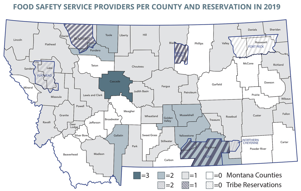
I have a background in science and understand data, which helps me illustrate it in unique ways. This map of Montana counties uses color and patterns to display the data allowing viewers a much clearer visual rather than just another table or graph in a paper.
Get a quote or reach out with a question on this quick form and I’ll get back to you within 24 hours!